
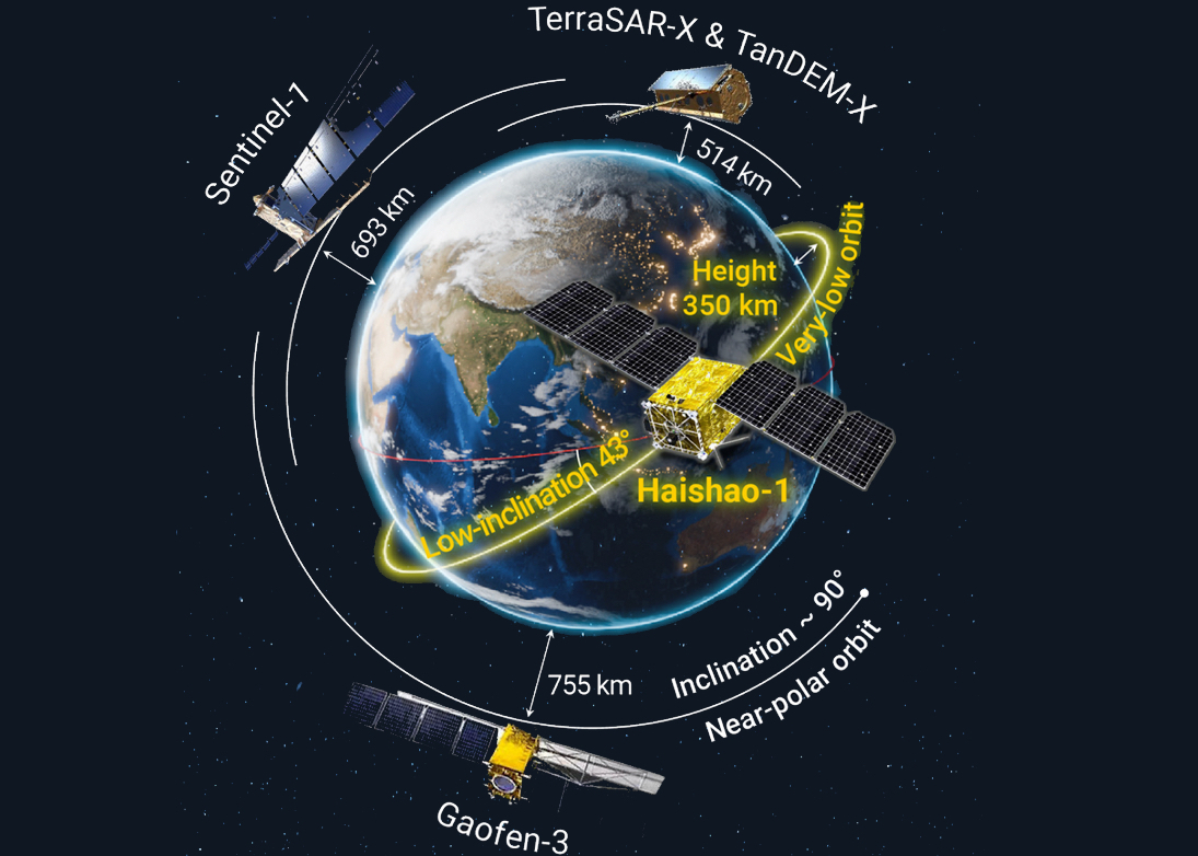
A new study highlights the launch of Haishao-1 (HS-1), China's first low-inclination orbit Synthetic Aperture Radar (SAR) satellite. This marks a breakthrough in global Earth observation.

A research team led by Prof. SHI Yusheng from the Aerospace Information Research Institute of the Chinese Academy of Sciences has developed a novel solution. This approach provides high-precision CO2 emission estimates from 14 large coal-fired power plants around the world, utilizing an enhanced Gaussian plume model and data from NASA's Orbiting Carbon Observatory-3 satellite.

A research team from the Aerospace Information Research Institute of the Chinese Academy of Sciences has released Africa's first high-resolution rice distribution map, featuring a resolution of 20 meters. This dataset provides comprehensive coverage of African countries where national-level rice cultivation areas exceed 5,000 hectares.
Researchers from the Institute of Computing Technology of the Chinese Academy of Sciences, along with collaborators, have developed a food-oriented large language model (LLM)—FoodSky, a domain-specific large LLM designed for culinary and nutritional applications.
A recent study has introduced a novel data-driven model that distinguishes between human-induced and natural water consumption in croplands, providing valuable insights into the sustainability of arid lake ecosystems.

A research team from the Aerospace Information Research Institute of the Chinese Academy of Sciences has released a long-term, high-resolution dataset that tracks global cropland water-use efficiency from 2001 to 2020. The dataset provides annual WUE estimates for croplands worldwide at a one-kilometer spatial resolution. It is expected to be a valuable resource for promoting sustainable agricultural water management.

86-10-68597521 (day)
86-10-68597289 (night)

52 Sanlihe Rd., Xicheng District,
Beijing, China (100864)
Copyright © 2002 - Chinese Academy of Sciences


