
Newsroom


A new study has reconstructed nearly 40 years of suspended sediment concentration data across the Yellow River, uncovering both a long-term downward trend and a recent reversal in this decline. By integrating decades of satellite observations with a newly developed retrieval model, the study illustrates how reservoirs, tributary inflows, vegetation restoration and check dams have collectively reshaped sediment dynamics along one of the world's most sediment-rich waterways.
Suspended sediment concentration serves as a core indicator of river ecological health, influencing channel evolution, delta formation, flood risk profiles and aquatic ecosystem stability. Sediment load has long dictated the hydrological behavior of the Yellow River, particularly as it traverses the highly erodible Loess Plateau. While previous ground-monitoring observations have documented a substantial drop in sediment runoff over recent decades, such site-based data is limited to discrete locations and fails to capture basin-wide long-term sediment variations.
To fill this research gap, a team from the Aerospace Information Research Institute of the Chinese Academy of Sciences (AIRCAS), in collaboration with partner researchers, has established a continuous full-basin sediment monitoring framework for the river system, moving beyond reliance on sparse hydrological station records.
Their findings were recently published in Journal of Remote Sensing.
The study reveals a clear spatial pattern: sediment concentrations generally rise from the upper reaches toward the river estuary, with sharp local reductions near major reservoirs and prominent surges where sediment-laden tributaries converge with the main channel. Temporally, sediment variations fall into three distinct phases: an upward trend from 1986 to 1997, a pronounced decline between 1997 and 2016, and fluctuating concentrations after 2016 — marking a definitive break from the earlier sustained downward trajectory.
Human activities have been identified as the primary driver behind these shifts. Reservoir sediment trapping accounts for 58.6% of annual sediment fluctuation, followed by vegetation restoration at 23.7% and check dam construction at 6.7%. These anthropogenic factors outweigh natural influences including precipitation, wind speed and river runoff.
To complete this reconstruction, the team developed a segmented retrieval algorithm tailored to the Yellow River's wide range of sediment concentrations. The researchers analyzed 12,426 cloud-free satellite images captured between 1986 and 2023, utilizing data from Landsat 5 TM, Landsat 7 ETM+ and Landsat 8 OLI sensors. The model was calibrated with field samples collected in 2022–2023 and extended across earlier sensors through cross-calibration.
Validation tests confirmed high model accuracy, with R2 values reaching 0.94 for Landsat 8 OLI, 0.96 for Landsat 7 ETM+, and 0.95 for Landsat 5 TM. Spatially averaged sediment concentrations were recorded at 742.7 mg/L in the upper reaches, 899.8 mg/L in the middle reaches, and 1,244.8 mg/L in the lower reaches. The river's basin-wide sediment peak was recorded in 1996–1997 at 1,265.7 mg/L, while the lowest sediment levels were observed in 2016–2017 at 530.5 mg/L.
The study integrated field sampling, satellite remote sensing and statistical modeling for comprehensive analysis. Water samples were collected synchronously with satellite overpasses, and sediment concentrations were calculated via a three-segment spectral inversion model based on visible and near-infrared spectral bands. Water body extraction adopted the Modified Normalized Difference Water Index (MNDWI), while long-term trend analysis employed the Theil–Sen estimator and Mann–Kendall statistical tests.
The researchers noted that this study delivers the first holistic, long-term assessment of basin-wide suspended sediment dynamics across the entire Yellow River, while pinpointing the recent shift in the river's declining sediment trend.
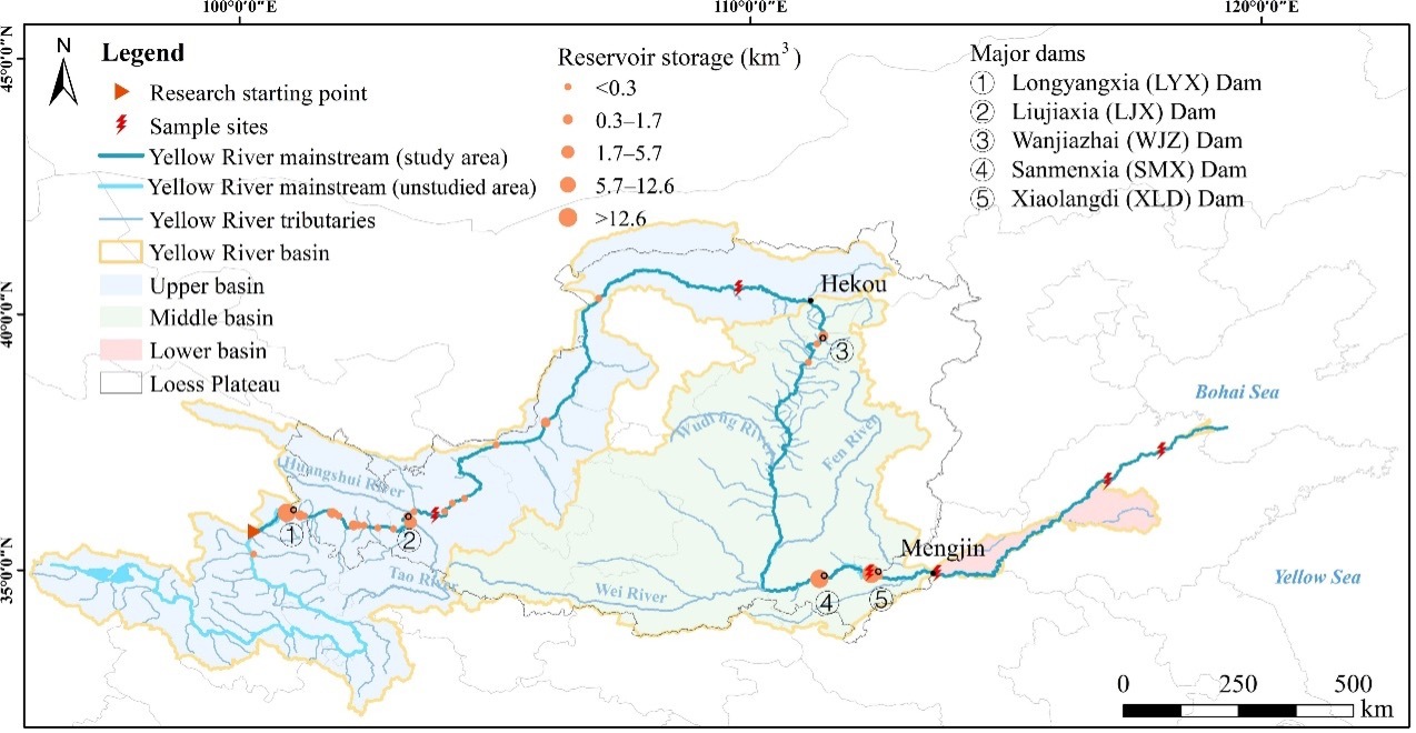
Map of the Yellow River basin showing the distribution of major rivers, reservoirs, and sampling sites. (Image by AIRCAS)
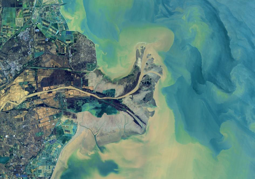
Estuary of the Yellow River. (Image by AIRCAS)
