Newsroom


On June 11, researchers from the Xinjiang Institute of Ecology and Geography (XIEG) of the Chinese Academy of Sciences unveiled the Land Cover Atlas of Five Central Asian Countries (1990–2020) at the second Belt and Road Conference on Science and Technology Exchange.
This atlas is the first bilingual (Chinese and Russian) professional land cover atlas for Central Asia, compiled by Chinese researchers. It is based on 1,040 remote sensing images covering the five Central Asian countries for the years 1990, 2000, 2010, and 2020. Utilizing advanced remote sensing and Geographic Information System (GIS) techniques, the researchers produced 202 land cover maps for these key years.
The atlas provides a comprehensive overview of spatial and temporal changes in land cover across Central Asia over the past three decades. It aims to support sustainable economic development and environmental protection efforts in the region, offering essential data for resource management, environmental conservation, and disaster monitoring.
As a baseline dataset for land use, the atlas establishes a solid foundation for sustainable development and international cooperation under the Belt and Road Initiative, contributing to regional economic prosperity and ecological balance.
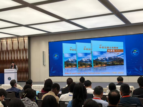
Release of the Land Cover Atlas of Five Central Asian Countries (Image by XIEG)