
Newsroom


A devastating 7.9-magnitude earthquake struck Myanmar on March 28, 2025, causing widespread damage in Mandalay, the country's second-largest city. The death toll has risen to 2,056, with approximately 3,900 individuals injured and nearly 270 missing, according to the Myanmar's State Administration Council Information Team on March 31.
In response to a request from the Department of Agricultural Research at Myanmar's Ministry of Agriculture, the ChinaGEO Secretariat activated its Disaster Data Response (CDDR) Mechanism. This initiative aimed to utilize China’s satellite imagery to support disaster response efforts.
More than thirty Chinese satellites were mobilized to execute an emergency observation plan for the earthquake-affected regions in Mandalay province and the capital city, Naypyidaw. Within five days, a significant amount of satellite post-disaster data, totaling 26.98 GB, was successfully delivered to the Myanmar Ministry of Agriculture. This data collection included imagery from Gaofen-1, Gaofen-6, and Jilin-1 optical satellites.
The ChinaGEOSS Data Sharing Network (ChinaGEOSS DSNet) hosted by the Aerospace Information Research Institute (AIR) of the Chinese Academy of Sciences (CAS), also shared the data with UNOOSA/UNPIDER and UNOSAT/UNITAR to assist with their rapid response assessment efforts.
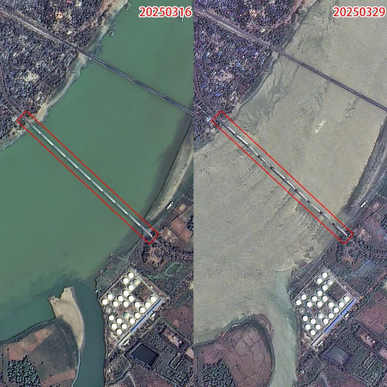
Preliminary satellite-derived bridge damage assessment at Myanmar's Mandalay as of 29 March 2025 (Image by Jilin-1 satellite)

Preliminary satellite-derived building damage assessment at Myanmar's Mandalay as of 29 March 2025 (Image by Jilin-1 satellite)
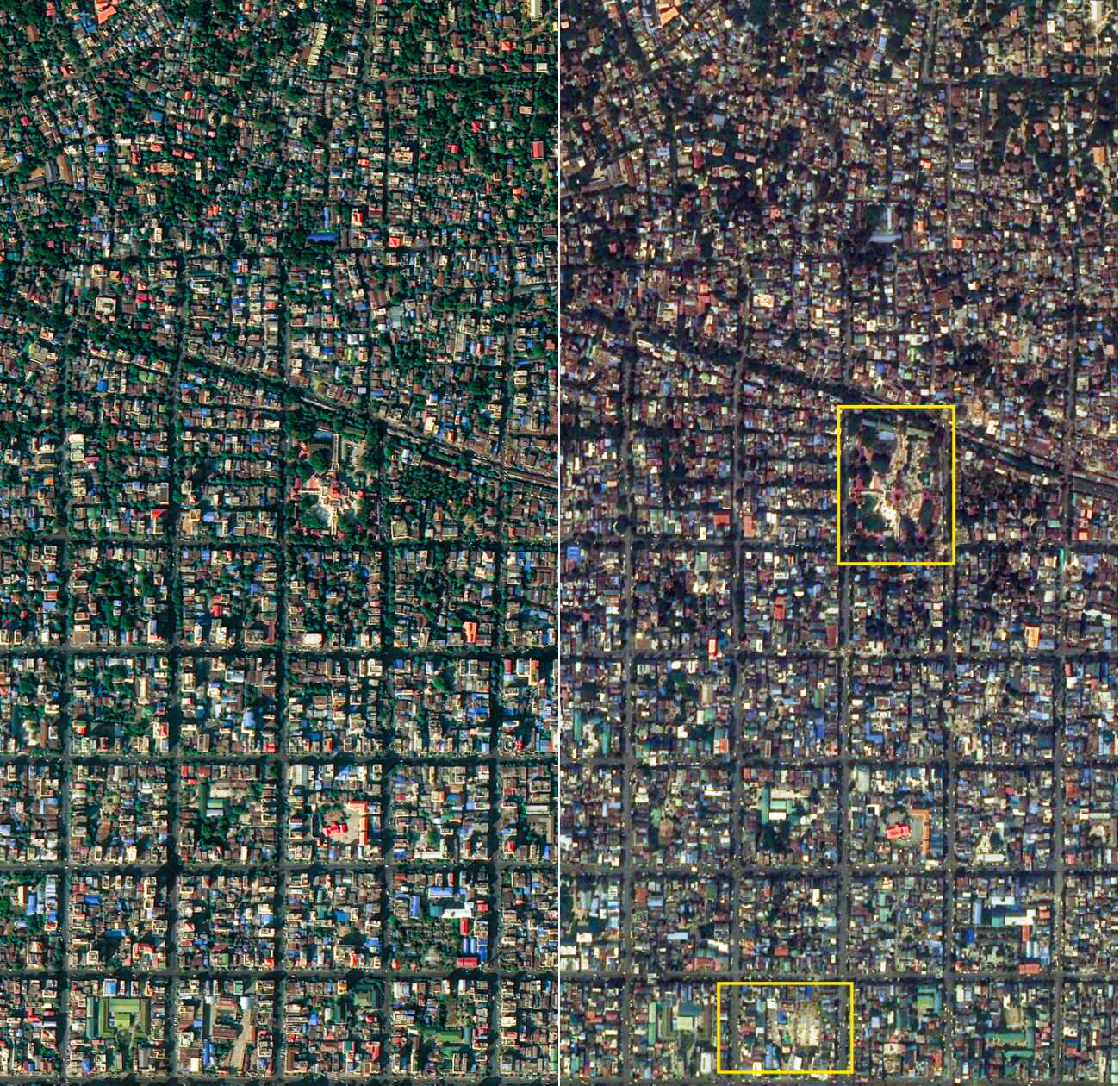
Preliminary satellite-derived temple damage assessment at Myanmar's Mandalay as of 29 March 2025 (Image by Jilin-1 satellite)