Since March 2023, central Africa has been hit by heavy rainfalls. Resulting floods and mudslides have caused heavy casualties and property losses in Kenya, Rwanda, Somalia and other countries.
At the request of the United Nations Institute for Training and Research (UNITAR), China GEO Secretariat activated its Collaborated network on Disaster Data Response (CDDR) Mechanism for these countries, and the Aerospace Information Research Institute (AIR) of the China Academy of Sciences (CAS) was responsible for collecting and analyzing China’s high-resolution satellite imagery in support of the disaster responses.
As of June 5, AIR has collected 13 scenes of archived pre-disaster data and 84 scenes of post-disaster data obtained from 24 satellites including GF-2, GF-3 and Jilin-1. The data covers severely affected areas such as Dadaab refugee camp in Kenya, western province of Rwanda and Beledweyne town in Somalia.
The Open Disaster Data Chain of the Chinese Academy of Sciences (ODDC) also provides authentication, version management, credible sharing and traceability of the above data.
Experts from AIR, Prof. LI Guoqing and Dr. ZHANG Lianchong, in partnership with UNITAR, produced six damage assessment products including the disaster-affected area, the affected population and the loss of infrastructure. The results were also reported to the United Nations Office for the Coordination of Humanitarian Affairs (OCHA), the International Charter on Space and Major Disasters, and local disaster response agencies, providing information support for disaster judgment, decision-making of emergency rescue measures.
Established in 2016, the CDDR Mechanism is responsible for coordinating the provision of Chinese high-resolution satellite data and disaster analysis products to disaster-affected countries. The mechanism has been successfully activated for 31 disaster responses, including Türkiye and Syria earthquake, New Zealand Cyclone Gabrielle, and Peru flood this year.
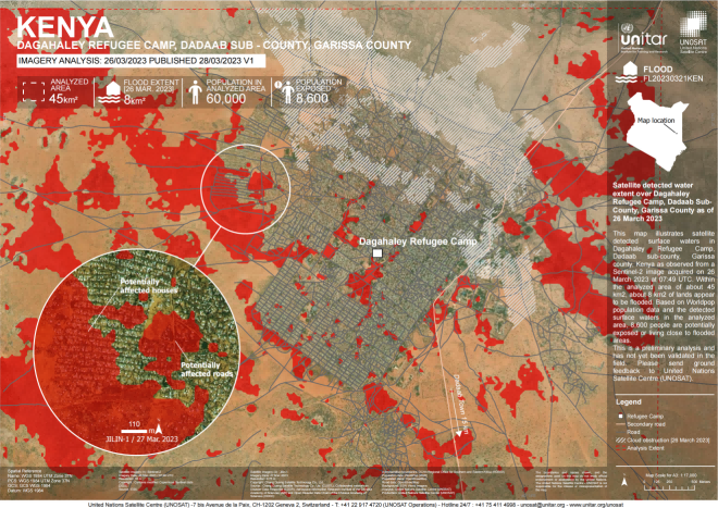
Satellite detected water extent over Dagahaley Refugee Camp, Garissa County, Kenya as of 26 March 2023. (Image by AIR)
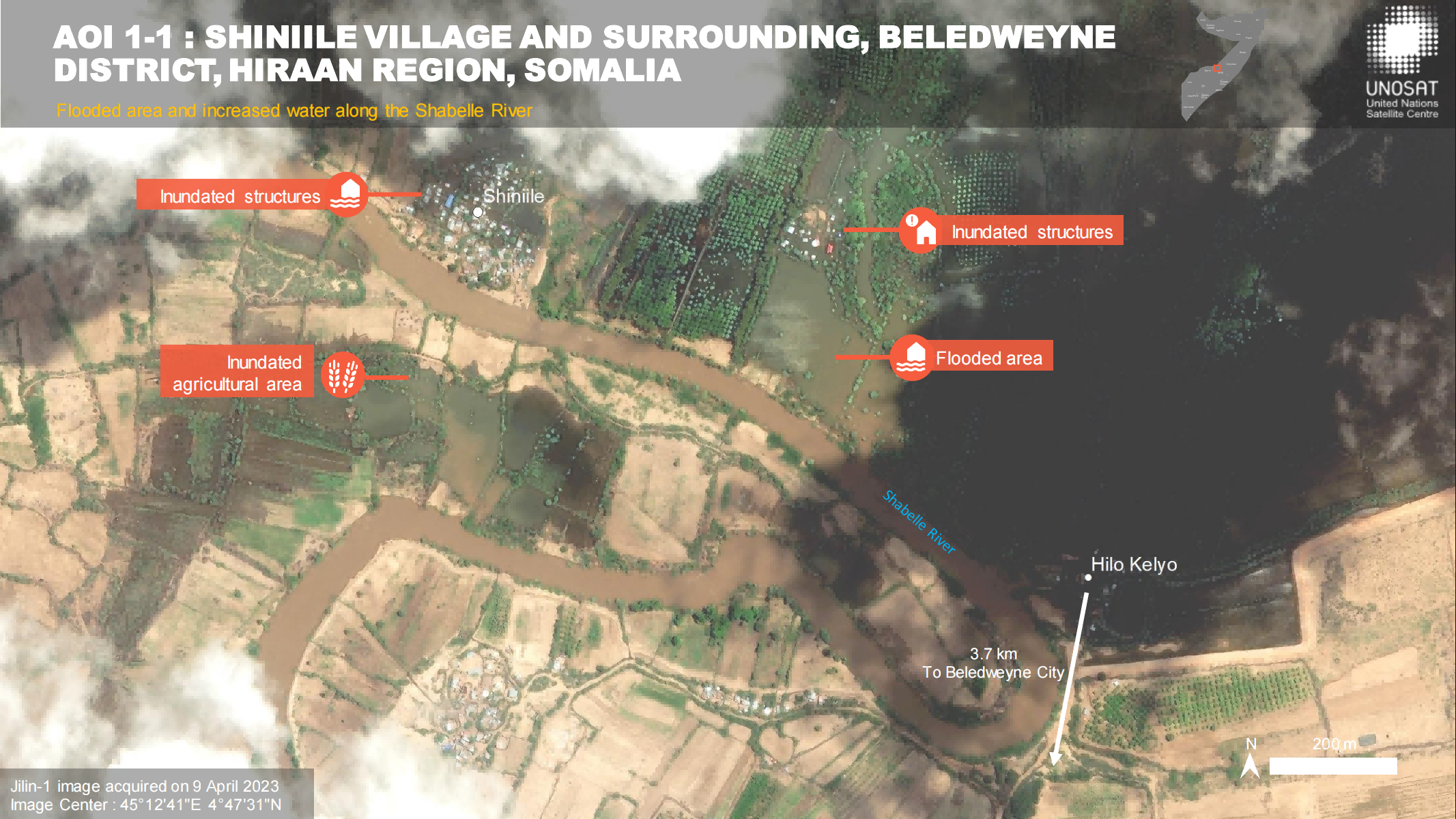
Preliminary Satellite Flood Assessment Report, Beledweyne City, Hiraan Region, Somalia- 14 April 2023. (Image by AIR)