
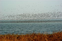
Known as the "kidneys of the Earth," wetlands can help safeguard biodiversity and cope with climate change. China's wetlands conservation efforts have illustrated its genuine commitment to ensuring harmonious coexistence between humans and nature.
Engineers from the China Remote Sensing Satellite Ground Station (RSGS), a big research facility hosted by the Aerospace Information Research Institute (AIR) of the Chinese Academy of Sciences (CAS) presented satellite images on several important wetlands of China to mark the World Wetland Day, which celebrates annually on February 2 to raise global awareness about the vital role of wetlands for people and planet.
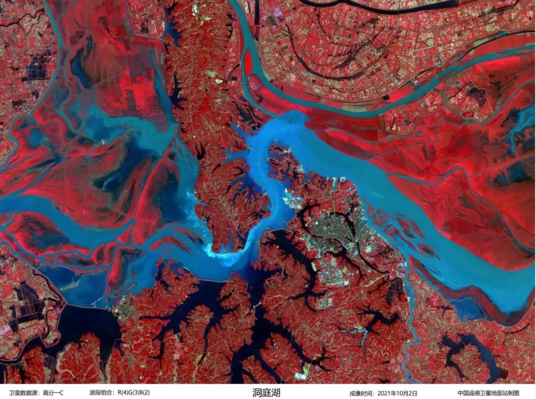
China's second largest freshwater lake, Dongting Lake is located in the middle reaches of the Yangtze River. It is also an important staging, wintering and feeding site for migratory birds, and provides a breeding ground and sanctuary for important aquatic species. (Image by AIR)
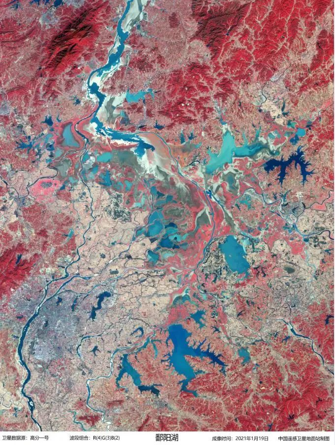
Poyang Lake is the largest freshwater lake ecological wetland in China, Poyang Lake's associated floodplain wetlands play a critical role for regional and global biodiversity conservation, particularly wintering migratory birds. (Image by AIR)
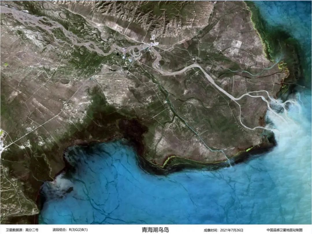
The Bird Island wetland is located in the west of Qinghai Lake in Qinghai Province, including the waters of Qinghai Lake, islands where birds breed and inhabit, beaches and lakeshore wetlands. (Image by AIR)
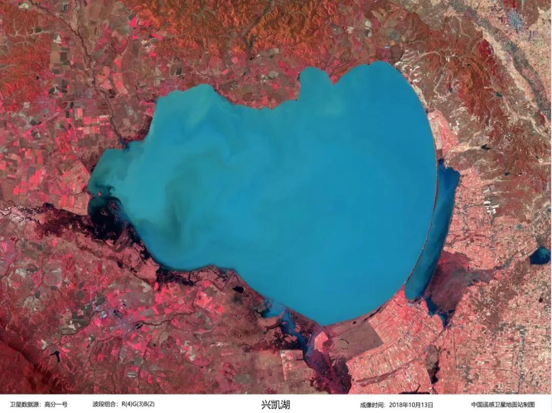
Xingkai Lake National Nature Reserve is an important part of the Sanjiang Plain wetland in China, boasting a wetland ecosystem with extremely rich biodiversity. (Image by AIR)
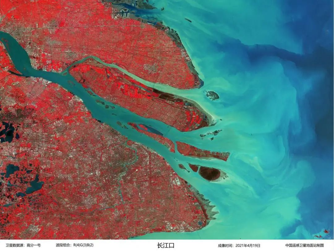
The wetland in the middle and lower reaches of the Yangtze River is the largest artificial and natural wetland ecosystem in China, and it is one of the regions with the richest wetland resources in China. (Image by AIR)
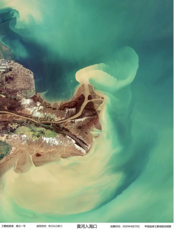
The Yellow River Delta boasts the most extensive and youngest wetland ecosystem in the warm temperate zone in the world. (Image by AIR)
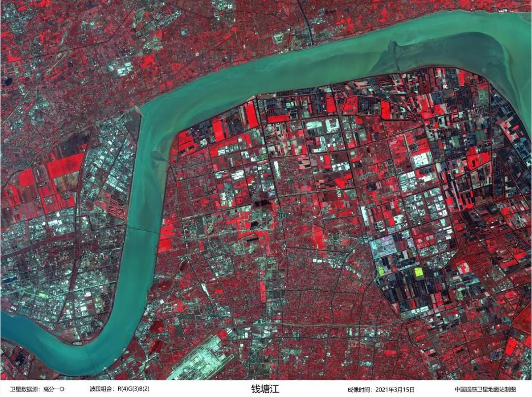
The middle and upper reaches of Qiantang River have complex wetland ecosystems such as rivers, islands, floodplains, oxbow lakes and aquaculture ponds. (Image by AIR)
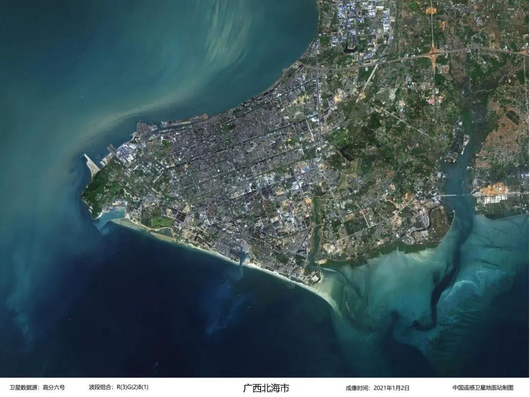
Beihai Binhai National Wetland Park at Guangxi Zhuang Autonomous Region includes reservoirs, rivers, coastal mangroves and tidal flats. (Image by AIR)
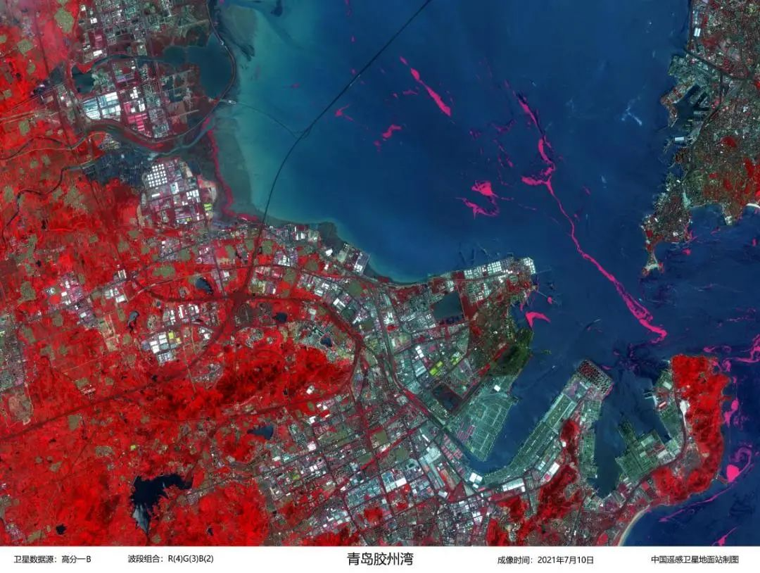
Jiaozhou Bay is the largest harbor wetland in Qingdao, an important bird area along the coast of China and a necessary stop on the migratory route of migratory birds in the Asia-Pacific region. (Image by AIR)


86-10-68597521 (day)
86-10-68597289 (night)

52 Sanlihe Rd., Xicheng District,
Beijing, China (100864)
Copyright © 2002 - Chinese Academy of Sciences


