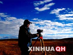


An explorer installs the GPS equipment.
In the twilight on the Qinghai-Tibet Plateau, an explorer installs a set of GPS equipment, and records the coordinates of his locality. Domestically developed by Chinese engineers, this device can work reliably despite the extreme conditions on the Plateau, and help scientists precisely determine the exact location and altitude of any a point with an error less than 5 cm, including those in sparsely inhabited areas, like the source areas of the three major rivers in China.
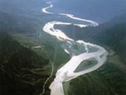
Equipped with state-of-the-art technologies including GPS, GIS and RS, Chinese scientists from the CAS and other academic organizations are now committed to a large-scale exploration under the auspices of Qinghai Provincial government to identify the true sources of the Yellow, Yangtze and Lancang (Lantsang, the upper reaches of the Mekong) rivers. All the rivers rank among the top 12 of the world in terms of length and are of the most importance for Asia. Starting on 6 September, this 40-member-strong exploration will last for about 45 days, covering a journey of about 8,000 km, in the hope of clearing the age-long clouds over the true origins of the three rivers, and collecting data for research on geographical, hydrographical and ecological changes of the involved drainage basins. It is expected that in mid-October the team will finish the exploration and by the end of November 2008, the sources of these rivers will have been determined, and data about their coordinates and elevations will be reported to the State Bureau of Surveying and Mapping.
The three rivers all originate from the southeastern part of the lofty Plateau, with each headwater close with the other. Glaciers on the "World's Roof" have been nourishing the catchment basins, supplying 25% discharge for the Yangtze River and respectively 49% and 15% for Yellow and Lancang rivers. This unique area enjoys a position of prestige as the "Asian Water Tower," for its enormous water resources.
No continuous hydrological record is available, however, for this area, and the complicated networks of rivers, trickles, lakes and marshes make it very difficult to identify the real sources of these major bodies of waters. Since ancient times, many efforts have been made to determine the headwaters of the Yangtze and Yellow rivers, but what resulting from the previous work were just rough, controversial conclusions, saying the Yangtze gains its first flow from a glacier lying on the west of Gêladaindong Mountain in the Tanggula (Dangla) Mountain Range, and the Yellow River from another one in the Bayan Har Mountains. Clearer conclusion was made concerning the headwater for Lancang River as a result from surveys conducted in 1994 and 1999 by the CAS, yet different opinions exist and the related data are still in need of update.
Abounding with the widest range of wetland types and enriched biological diversity, this vast land on the Plateau plays a vital role in maintaining the ecological security and water supply for the country, and meanwhile it is also of ecological importance for Asia and even the world, given its unique value in research on global change.
Research has proved that the Qinghai-Tibetan Plateau not only has impacts on the weathers and climates of China and East Asia, but also on the global atmospheric circumfluence. This endows the source areas of the rivers extra significance for the whole planet. Over the past decades, in response to the global warming, the glaciers and snow line have kept retreating, with shrinkage and even dry-up of the once multitudinous and lush lakes, wetlands and marshes. As a result, the source areas are seeing striking and worrying changes in their endemic vegetation, climate and capacity of water conservation. This land has been made a fantastic object for ecological, geological, geographic and meteorological research, attracting interests from cartographers, geologists and explorers from all over the world, and the unsettled question of the exact origins of the rivers has just added to its glamour.
This expedition is the first effort ever in Chinese history to investigate the sources of all the three major rivers at the same time. Once the exact sources are located, geographic signs will be officially erected on the sites upon the approval of the State authorities. Data collected in this move will fuel further geological and ecological research.
"It is a major scientific issue to determine the sources of major rivers. Despite the many explorations conducted in ancient times, the real sources remain unknown due to the poor conditions available before," emphasizes Prof. SUN Shu, a CAS Member and the director of the expert panel for this exploration.
Teaming up experts from multiple disciplines like mapping, hydrology, glaciology, geology, meteorology and geography, this record exploration is anticipated to make a history. Dozens of prestigious scientists are involved, including CAS Member Prof. XU Guanhua, an expert at remote sensing and former Chinese minister of science and technology; CAS Member Prof. QIN Dahe, a glaciologist and the first Chinese to across the South Pole; and CAS Member Prof. CHEN Yiyu, an ichthyologist and the current president of the National Natural Science Foundation of China. A total of 11 CAS Members are engaged in the exploration and the position of principal investigator is held by Prof. LIU Shaochuang from the CAS Institute of Remote Sensing Applications.
This expedition will have to across the shivery mountainous area over 4,000 meters above sea level, and manage to survive the tenuous air at the great height. The wetlands everywhere stop even the most adaptable motor vehicles. Because of the unfavorable topography plus the abominable weather, access to many locations is only possible by horseback riding or, even worse, walking.
In line with their original plan, the expedition would arrive on 8 September at the source area of Yellow River and camp there, and thereafter the team will conduct survey of its three tributaries before moving on. Unfortunately, bad weathers accompanied the expedition at the very beginning of the trip, and the unexpectedly large rainfall caused floods and blocked the roads. The team had to change their plan and move to the source area of the Lancang River in Zadoi County first. After finishing the investigation in the source waters of Lancang there and one of the tributaries of Yangtze nearby, the main forces would travel back to the source area of the Yellow River and carry out this part of exploration.
Based on field surveys conducted in 1994 by a joint team from the CAS and Tokyo University of Agriculture and in 1999 by an expedition sponsored by the China Association for Science Exploration, scientists with the CAS Institute of Geographic Sciences and Natural Resources Research, Profs. ZHOU Changjin and GUAN Zhihua reported their reconfirmation on identification of true source and headwater of Lancang River in the May issue of Geographical Research in 2001, stating that the true source of Lancang River is in the Zayaqu, which starts from Guosongmucha Mountain at an altitude of 5,514 meters above sea level in Zaqing, Zadoi county, Yushu Tibetan Autonomous Prefecture, Qinghai Province of China.
This conclusion took into account not only the length, but also drainage area and discharge. It did not put the end to the controversy, however. According to Prof. Liu, different opinions exist in academic community, with supports mainly going to two views, one of which insists on the Zayaqu, one of the two major tributaries, is the true source, while the other argues that the other tributary, called Zanaqu, is the real headwater. The current survey will provide scientists with more sufficient data to clarify this enigma.
Guided by local Tibetans, the explorers started their discovery journey on horseback from their camps within Zadoi County at over 4,700 meters above sea level and arrived at the Zayaqu on 12 September. They would carry out the following missions: first of all, to identify the true source and measure the coordinates and altitude of its location; second, to collect related geographic data; third, to take soil samples in local area; and fourth, to quantitatively analyze the environmental situation, and track out the changes over the past few decades by comparing the data collected now with the aerophotography from the 1960s and the satellite photos from the 1970s.
The team entered the depth of the Guosongmucha Mountains to investigate the upper reaches of the Zayaqu and collect first-hand data concerning the fundamental geographic and hydrological situation. After that, the team advanced to the other tributaries, the Zanaqu, which is credited by local people as the legendary source, and the Sarikaqinqu, which was believed by a French expedition as the real source.
At the time, the exact geographic location of the source of Lancang River remains elusive, and calls for follow-up analysis of the data. Leaving this enigma unsolved, on 20 September, the expedition marched on to the southern source of the Yangtze, the Dam Qu. This tributary flows from the north slope of the Dangla Mountains in the precinct of Zadoi County and is believed to be the most possible real headwater for the longest river in China. Towards the upriver area of this flow, in sight is a vast, complicated network of marshes and trickles spreading over hundreds of square kilometers. Basically unpopulated, this area encompasses the largest peat bog in the world.
Naturally, this journey was exceedingly hard. According to the captain, Prof. TANG Qianli, the vice director of the Qinghai Bureau of Surveying and Mapping, this might have marked the most difficult days of this expedition. The Dam Qu has numerous upriver tributaries, and in some circumstances the adverse topography forced the expedition to trek on foot. Despite the difficulties, the expedition worked in groups and succeeded in collecting large amount of data concerning the meteorological, hydrological, geological, geographical, glaciological and other sides of environmental situation of the upper tributaries of the Dam Qu.
On 26 September, the expedition withdrew from Dam Qu and three days later started their next journey, the one back to the source area of the Yellow River, to resume their disrupted investigation there. After that, the team will push forward to the other important tributary in the source area of Yangtze, the Togton River, to crown the whole exploration by accomplishing the last mission. If everything goes well, by the end of November the real origins of the three major rivers will be unveiled.

86-10-68597521 (day)
86-10-68597289 (night)

86-10-68511095 (day)
86-10-68512458 (night)

cas_en@cas.cn

52 Sanlihe Rd., Xicheng District,
Beijing, China (100864)

