
Heihe River Basin, which is located in the middle of the Qilian Mountain and situated on the northeastern Tibetan Plateau, has attracted more and more attention in China due to its increasing pressure on water supply and the natural environment.
It is well known that climate change and land use/cover change (LUCC) are two critical factors influencing watershed hydrological changes. However, few scientific literatures and researches mentioned this topic, so it is necessary to separate the impacts of the climate change and LUCC factors on hydrological changes in order to accurately quantify their respective roles.
Recently, a research group led by Prof. FENG Qi from the Key laboratory of Eco-hydrology of Inland River Basin at Northwest Institute of Eco-environment and Resources (NIEER) identified the individual impacts of climate and land use changes on hydrological processes in headwater of Heihe River using a new method combined statistical analysis and hydrological method to improve the accuracy in separating the contributions of climate and LUCC to streamflow, to understand and identify the dominate factor affecting hydrological processes.
The research result shows that LUCC and climate change both increased runoff and evapotranspiration (ET) during last 30 years, the impact of climate exceeded by far that of LUCC. Climate change outweighed the impact of LUCC, showing respective increases in runoff and ET of 107.3% and 81.2% of total changes. At the same time increase in runoff caused by climate more than offset the decrease caused by LUCC.
By comparison, the LUCC influence was modest, showing changes occupied -7.3% and 18.8% of total changes, respectively. The outcomes show the climate factor accounted for effects more significant than LUCC on hydrological processes in the headwater of Heihe River.
This research is financially supported by the Key Research Program of Frontier Sciences, CAS (QYZDJ-SSW-DQC031), National Natural Science Foundation of China Project (41601038), China Postdoctoral Science Foundation (2015M572620), and Natural Science Foundation of Gansu Province (145RJZA141). This research is published on Hydrological Processes.
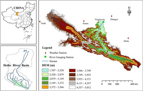
Fig. 1 Location of the Yingluoxia catchment with weather stations, river gauging stations, and digital elevation map (DEM) (Image by FENG)
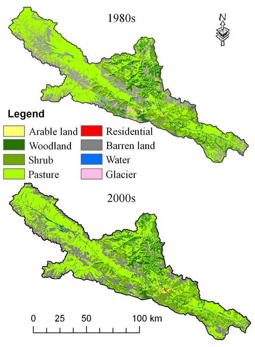
Fig. 2 Distribution of Land use for 1980s and 2000s in headwater of Heihe River (Image by FENG)

86-10-68597521 (day)
86-10-68597289 (night)

86-10-68511095 (day)
86-10-68512458 (night)

cas_en@cas.cn

52 Sanlihe Rd., Xicheng District,
Beijing, China (100864)
Copyright © 2002 - Chinese Academy of Sciences


