

Since 2012, LIU Shaochuang has led a team in tracking and studying wild camels using satellite remote sensing technology. Unlike zoologists who focus on species, Liu has studied the interrelationship between endangered animals and their environment, which he believes will...
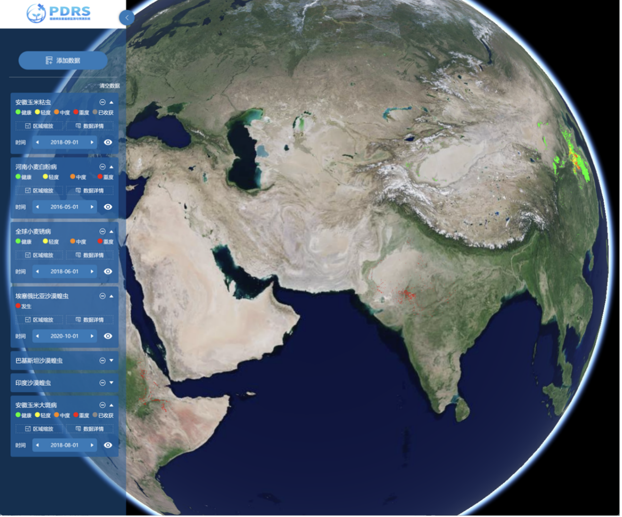
During the Third Conference on Remote Sensing of Vegetation Pests and Diseases held online on August 27, the Aerospace Information Research Institute (AIR) under the Chinese Academy of Sciences (CAS) released an upgraded version of vegetation pest and disease remote sensi...

86-10-68597521 (day)
86-10-68597289 (night)

86-10-68511095 (day)
86-10-68512458 (night)

cas_en@cas.cn

52 Sanlihe Rd., Xicheng District,
Beijing, China (100864)
Copyright © 2002 - Chinese Academy of Sciences


